FOEL FRAS SUMMIT.

FOEL FRAS SUMMIT.

Friday, 15 July 2011

#34.FAN Y BIG HORSESHOE.30-6-11.

Today's walk saw me visit the Brecon Beacon's with Howie where we met Dan (Willo off the forum) for this delightful walk taking in Fan y Big,Bwlch y Ddwyallt (Gwaun Cerrig Llwydian) and Waun Rydd.We parked in the Tal Fechan Forest and took the lane to the east of the Neuadd Reservoir's.
  
It was overcast at first but nice and mild.Looking down on the reservoir.

It is only 2.5 mile to the summit of Fan y Big with 1,000 feet of ascent and it is quickly reached.Just off the summit is the "diving board",a rocky ledge with a blooming big drop down.Here's me on it with Pen y Fan in the distance.

Distant view to Llangorse Lake and Mynydd Troed.

By now the cloud was breaking up and it was getting very warm.

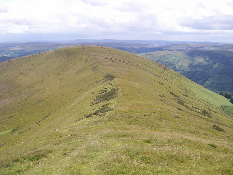
The walking above Craig Cwareli is easy giving lovely view's down the Cwm Oergwm valley.

The summit of Bwlch y Ddwyallt was passed before we took in a minor top marked by it's height,769 metres, we then made for the cracking cairn above Craig Pwllfa.

We then dropped down the ridge of Craig y Fan and as my knee was hurting i rested whilst the boy's made the there and back route to bag Allt Lwyd.

Next the boy's wanted to visit the memorial cairn to the Wellington Bomber that crashed in July 1942 killing all the Canadian Airmen,so i put the co-ords. in my GPS unit and we set off above Cwar y Gigfran to find it.It is located below the cliff's and care was needed getting down to it.


From here we followed the path above Graig Fan Las to reach the Caerfanell stream.The sun now beaming down on us.

We joined the Beacon's Way LDFP before following this stream back to the car park.

We then popped in the White Hart in Talybont-on-Usk for a pint sitting in the beer garden beside the Monmouthshire and Brecon Canal,what a great way to end a great day.

Today's total's were 10.5 miles with 2,000 feet of ascent visiting 4 tops.


MILEAGE        247.5
ASCENT          57,500
TOPS               66.

Friday, 8 July 2011

#33.TATRA NATIONAL PARK.24+25-6-11.

Whilst on holiday in Zakopane,South Poland we took in 2 small walk's in the Tatra Nationa Park.On friday we took the cable car up to Kasprowy Wierch,we had to endure a 3 hour wait in the queue but it was well worth it for the view's when we got to the top.Looking to Beskid.

View into Slovakia.

The ridge to Beskid follow's the Polish Slovakian border and is marked by these marker post's.

Me at the summit of Beskid which is 2,012 metres,6,601 feet high,the highest mountain we have been on.The pointy one behind is Swinica which is 2,301 metres and 7,549 feet high.

We took a detour on a path that led into Slovakia for a while.

Before climbing up to the summit of Kasprowy Wierch which is 1,987 metres and 6,519 feet high.

We then walked to the cable car station for the ride down.

The plan for saturday was to walk up Giewont,1,894 metres and 6,213 feet tall.The weather was overcast and raining at first as we paid to enter the park and followed the stream up to Siklawica waterfall.


The going was easy up to here but now it started to get steep as we made our way through the tree's.

Looking on the map i bought i reckon we were 4/5ths of the way up before we were hit by a massive rain/hail storm,the heaviest rain i've ever been out in,and then the loudest clap of thunder i've ever heard overhead so we made a hasty retreat back down the mountain.Here's Julie in the rain/hail.

Sarnia Skala.

Within the hour the sun was shining and Giewont was clear.


Total distance walked was 15 miles with 3,000 feet of ascent and 2 top's.


MILEAGE         237
ASCENT          55,500
TOPS               62

Monday, 13 June 2011

#32.STOODLEY PIKE.12-6-11.

After the last 2 small walk's my knee has been ok i decided to get a little bit of ascent into my next walk.As we were staying in Todmorden,because we had been to the Hebden Bridge Hand Made Festival on the saturday,i did a bit of research and found a hill called Stoodley Pike which was topped by a magnificent monument nearby and decided to walk this on the sunday morning.The weather forecast was for a dry morning with rain due to arrive by the afternoon so we set off bright and early from Todmorden and drove up to park at the Top Brink public house in between the villages of Lumbutts and Mankinholes.

This is a very popular walk and the path is well paved all the way up to the summit,the lower flank of the mountain being quite steep in places had me and Julie puffing and panting as we haven't walked anything as steep as this for nigh on 6 week's.

View back to where our car was parked.

Monument in the distance.

Walking on this side of the mountain we were sheltered from the wind and got a sweat on but as soon as we had reached the monolith where we left the Calderdale LDFP we were to feel the full force of a very cold wind all the way to the monument.

It was a relatively flat walk all the way to the summit across the moor which was full of cotton grass.

We were now on the Pennine Way LDFP,this run's right past the monument.This monument was completed in 1856,replacing an earlier structure that was built in 1815 but collapsed in 1854 when lightning hit it.A lightning conductor was added in 1889 and although being hit many times since by lightning it has not suffered any damage.The height of the monument is 121 feet and very impressive indeed.


The monument contain's a spiral staircase of 39 step's and gives access to a balcony 40 feet above the ground.It was pitch black inside and care was needed when ascending the step's,but it gave us a great view from the balcony.


View down to Todmorden.


Julie descending the spiral staircase.


The Webster memorial seat that gave us some shelter from the wind.


We timed this walk perfectly for as we got back to the car it started to rain and it rained all the way home and until night time.The distance of this walk was 6 miles with 1,000 feet of ascent.


MILEAGE      222
ASCENT        52,500
TOPS            60.

Tuesday, 7 June 2011

#31.BISHOP BENNET WAY.

With my knee feeling ok'ish i decided to take in a stretch of the BISHOP BENNET WAY long distance footpath and to try to complete the series of geo-cache's that have been hidden along the route.The walk was 5 miles in length with 100 feet of ascent and it took me 2.5 hours to find all 21 cache's hidden.I forgot my camera so no photo's to add.

MILEAGE     211
ASCENT       51,500
TOPS             59.

Monday, 6 June 2011

#30 BRYN Y GAER.5-6-11.

Seriously going stir crazy having not walked for 4 week's and my knee still giving me gip i decided to try this little local walk to see how my knee would hold up.Me and Julie parked the car in Caergwrle,walked passed the now closed Derby Arms public house,across the packhorse bridge and up to Hawarden road.We walked for a while on the Wats Dyke long distance footpath before turning away to join the path that lead's to Bryn y Gaer.Found a few geo-caches along the way before heading up to Caer Estyn through the tree's.

After skirting the disused quarry we headed back to the road to find a cache by the road bridge.

We then retraced our footstep's to the packhorse bridge,found another cache here.

The path now go's past the old Caergwrle Brewery on our way back to the car.A pleasant little stroll of 2.5 miles with 400 feet of ascent.


MILEAGE         206
ASCENT           51,400
TOPS                 59.

Wednesday, 11 May 2011

#29.The Tennyson Memorial,Isle of Wight.6-5-11.

Our week's holiday in Lymington,the Isle of Wight and Malmsbury had promised a lot of walking but due to my injured knee we didn't do much but did manage a slow painful walk up to the Tennyson Memorial on Tennyson Down on the south west corner of the Island.We left the car in Freshwater Bay and walked the 1.5 mile to the memorial,the view's from the top are fantastic even though it was a little hazy.Distance 3 miles with 500 feet of ascent.


Amended mileage and ascent.
MILEAGE         203.5
ASCENT           51,000
TOPS                59.

#28.Froncysyllte to Llangollen and back.30-4-11.

Walking around town the previous night my knee "went",it was hurting bad.I assume i have done too much walking lately and the strain was telling.Today i had planned to do the North Berwyn Way with Micky but was in no fit state so decided on the easier Llangollen walk.Richard dropped me and Micky off in Trevor and we followed the Offa's Dyke footpath up through Trevor Wood and onto the Panorama.We followed the newly tarmac'ed road to Castell Dinas Bran,here as my knee was hurting i traversed the castle by the low level path whilst Micky went over the top and met me on the other side.We walked down into town and had a pint at the Bridge End,sitting chatting with Pip,before walking down the canal back to Froncysyllte.Again i took the shortest path back to meet Julie and Sue whilst Micky took the detour over the aqueduct.8 (painful) miles with 1,300 feet of ascent.


MILEAGE         192.5
ASCENT           67,350
TOPS                58.