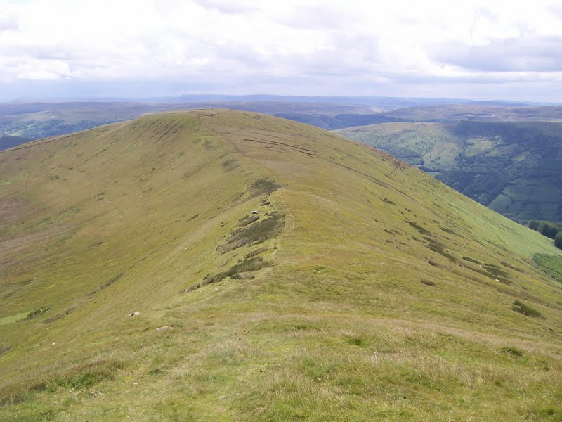
FOEL FRAS SUMMIT.

FOEL FRAS SUMMIT.

Sunday, 17 July 2011

#36.CRIB LEM SPUR HORSESHOE.9-7-11.

Today's walk saw me revisit the Carneddau to take in Carnedd Dafydd (via the Crib Lem Spur),Carnedd Llewelyn and Yr Elen accompanied by Julie and Julian and Deb off the walking forum.We were to meet Julian and Deb at Ogwen Cottage and whilst we were waiting for them i had a chat with the warden in his office and asked him what the weather forecast was for the day.He proceeded to tell me that it was for light rain in the morning ,heavy rain for the afternoon and low cloud all day,exactly what the BBC had predicted.After meeting the other's we drove up to Gerlan to park and we all resigned ourselves to getting wet and not seeing much all day.We took the minor road out of Gerlan that lead's to the Afon Llafar and followed this river all the way to the impressive cliff face of Llech Ddu.
 First glimpse of Llech Ddu and the low cloud.

       The quartz band above Llech Ddu that herald's the start of the scrambling.                 

Although cloudy it was very warm as we were sheltered from the wind and i tried to get a drink of water from our new platypus but as hard as i sucked nothing was coming out,so on closer inspection we noticed there was no hole it the end of the spout.Deb came to the rescue and produced a knife so i could pierce the end of the spout and enable the water to flow out.As we neared Llech Ddu it started to rain so we all donned our waterproofs and we made our way steeply up to the left of the waterfall on our way to the quartz band,


Halfway up the waterfall the rain stopped and we got a break in the cloud and the sun started to shine so we took off our wet gear.Below is Foel Meirch and Mynydd Du.

Assembled at the quartz band the scrambling started so it was trekking poles away and all hand's on deck.


The weather was improving all the time with the cloud slowly dispersing giving us better view's as we gained height.Could the weather forecaster's have got it wrong?,surely not.


Crib Lem is a varied scramble ranging from very easy to some really tricky bit's that requires you to take great care or to even miss bit's out and find an alternative way up.


By now the cloud had lifted and we could see the top's of Yr Elen and Carnedd Llewelyn.Below,the cloud lifting over Ysgolion Duon.

No time to hang around,back to the scrambling.


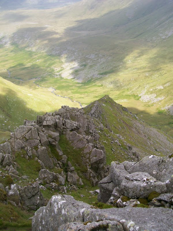
Scrambling over all that is left is a short trudge up to the summit of Carnedd Dafydd where we had some food and drink to set us up for the rest of the day.Although now cloudless and very sunny the wind had a bite to it,me and Deb feeling it more than Julie and Julian who walked all day in their t-shirt's whilst me and Deb wore our fleece and gloves as we suffer from Reynauds.Summit photo.

In contrast to the solitude on the scramble where we never saw a sole there were alot of other walker's about enjoying the high Carneddau.We made our way above the Black Ladders on route to Carnedd Llewelyn giving us fine view's down to the Llafar Valley and our scramble.


      Ahead lies the steep climb up to Carnedd Llewelyn.                                   
                                                             
 Julie at the summit.

Ahead lies the shapely peak of Yr Elen,one of the quieter mountain's of Eryri.

From here you get a great view of Carnedd Dafydd and the Crib Lem Spur.

Leaving Llewelyn on route to Yr Elen.                                                 
                                                             
Summit photo.

Leaving Yr Elen via the scree we headed for the minor top of Foel Ganol,now out of the wind and very hot in the sunshine,what happened to the rain and mist,bloody forecaster's.

 Looking back to this fantastic walk.                                                       

Another fantastic day in the hill's with fantastic company and weather.We then drove to the Ty'n y Coed and met up with Howie,Julia,PistonPete and Sue where we had a meal and a few scoop's.Distance walked was 9.5 mile with 3,900 feet of ascent and 3 tops.


MILEAGE         268
ASCENT           63,000
TOPS                70.

Friday, 15 July 2011

#35.ANGLESEY COASTAL PATH.1+2-7-11.

With the weather set fair i booked an overnight stop in Holyhead for me and Julie and we took in 2 fine walk's.On the friday with the tide going out around dinner time i thought it would be a perfect time to walk to Porth Cwyfan and see "Church Island" with the tide still in.Parking at Aberffraw we took the path along side the Afon Ffraw with it's great view's to the mountain's of the Lleyn Peninsula.


Even though it was early in the morning it was very warm in the sun and when we reached the coast we had extensive view's to all of the high Snowdonia mountain's,this really is a fantastic viewpoint.The path now head's above Braich Lwyd.

Soon we got our first glimpse of the church perched high on it's little island.

We had a short wait until we could cross the causeway to reach the church.


After a short break on the island we retraced our step's back to Aberffraw.

On saturday we parked by the lifeboat station and took the road that lead's to the Breakwater Country Park.Today was even hotter and i soon got bit by a cleg so we paused to put on some deet and were not bothered again all day.After passing through the park we took the steep incline heading for Holyhead mountain.


Me and Julie at the summit trig point.

We dropped down onto the coastal path which took us to the North Stack.


From the signal station the path head's along a lovely stretch of path close to the cliff edge.


The Skerries.

The view back to where we had walked.

The 2 walk's totalled 11 mile with 1,600 feet of ascent.


MILEAGE         258.5
ASCENT          59,100
TOPS               67.

#34.FAN Y BIG HORSESHOE.30-6-11.

Today's walk saw me visit the Brecon Beacon's with Howie where we met Dan (Willo off the forum) for this delightful walk taking in Fan y Big,Bwlch y Ddwyallt (Gwaun Cerrig Llwydian) and Waun Rydd.We parked in the Tal Fechan Forest and took the lane to the east of the Neuadd Reservoir's.
  
It was overcast at first but nice and mild.Looking down on the reservoir.

It is only 2.5 mile to the summit of Fan y Big with 1,000 feet of ascent and it is quickly reached.Just off the summit is the "diving board",a rocky ledge with a blooming big drop down.Here's me on it with Pen y Fan in the distance.

Distant view to Llangorse Lake and Mynydd Troed.

By now the cloud was breaking up and it was getting very warm.

The walking above Craig Cwareli is easy giving lovely view's down the Cwm Oergwm valley.

The summit of Bwlch y Ddwyallt was passed before we took in a minor top marked by it's height,769 metres, we then made for the cracking cairn above Craig Pwllfa.

We then dropped down the ridge of Craig y Fan and as my knee was hurting i rested whilst the boy's made the there and back route to bag Allt Lwyd.

Next the boy's wanted to visit the memorial cairn to the Wellington Bomber that crashed in July 1942 killing all the Canadian Airmen,so i put the co-ords. in my GPS unit and we set off above Cwar y Gigfran to find it.It is located below the cliff's and care was needed getting down to it.


From here we followed the path above Graig Fan Las to reach the Caerfanell stream.The sun now beaming down on us.

We joined the Beacon's Way LDFP before following this stream back to the car park.

We then popped in the White Hart in Talybont-on-Usk for a pint sitting in the beer garden beside the Monmouthshire and Brecon Canal,what a great way to end a great day.

Today's total's were 10.5 miles with 2,000 feet of ascent visiting 4 tops.


MILEAGE        247.5
ASCENT          57,500
TOPS               66.

Friday, 8 July 2011

#33.TATRA NATIONAL PARK.24+25-6-11.

Whilst on holiday in Zakopane,South Poland we took in 2 small walk's in the Tatra Nationa Park.On friday we took the cable car up to Kasprowy Wierch,we had to endure a 3 hour wait in the queue but it was well worth it for the view's when we got to the top.Looking to Beskid.

View into Slovakia.

The ridge to Beskid follow's the Polish Slovakian border and is marked by these marker post's.

Me at the summit of Beskid which is 2,012 metres,6,601 feet high,the highest mountain we have been on.The pointy one behind is Swinica which is 2,301 metres and 7,549 feet high.

We took a detour on a path that led into Slovakia for a while.

Before climbing up to the summit of Kasprowy Wierch which is 1,987 metres and 6,519 feet high.

We then walked to the cable car station for the ride down.

The plan for saturday was to walk up Giewont,1,894 metres and 6,213 feet tall.The weather was overcast and raining at first as we paid to enter the park and followed the stream up to Siklawica waterfall.


The going was easy up to here but now it started to get steep as we made our way through the tree's.

Looking on the map i bought i reckon we were 4/5ths of the way up before we were hit by a massive rain/hail storm,the heaviest rain i've ever been out in,and then the loudest clap of thunder i've ever heard overhead so we made a hasty retreat back down the mountain.Here's Julie in the rain/hail.

Sarnia Skala.

Within the hour the sun was shining and Giewont was clear.


Total distance walked was 15 miles with 3,000 feet of ascent and 2 top's.


MILEAGE         237
ASCENT          55,500
TOPS               62