Moel Wnion has been on my to-do list for a number of year's now having looked across to it whenever i have walked in the northern Carneddau and being impressed by it's size,it being 1,920 feet high (580 metres) and a Dewey.With the weather being very sunny if a little bit chilly i arranged to meet Clive at Howie's house at 9 a.m. and i drove us to the lovely village of Rachub on the outskirt's of Bethesda and we were walking for 10 a.m. We walked toward's Bethesda on the narrow lane and when we reached Cilfodan,below the Pen-y-gaer mast,we turned left up the narrow lane which gave us our first decent view of the Penrhyn Slate Quarry and the northern Glyderau.
The lane takes you past the lovely little terrace of Tan-y-foel,seen below with Moel Faban providing the backdrop.
Passing the isolated Tyddyn-sable we continued to gain height as the tarmac surface gives way to a lovely green lane.
Carneddau ponies out in force today enjoying the sunshine.
Below,view back to the Glyderau.
And Penrhyn Castle.
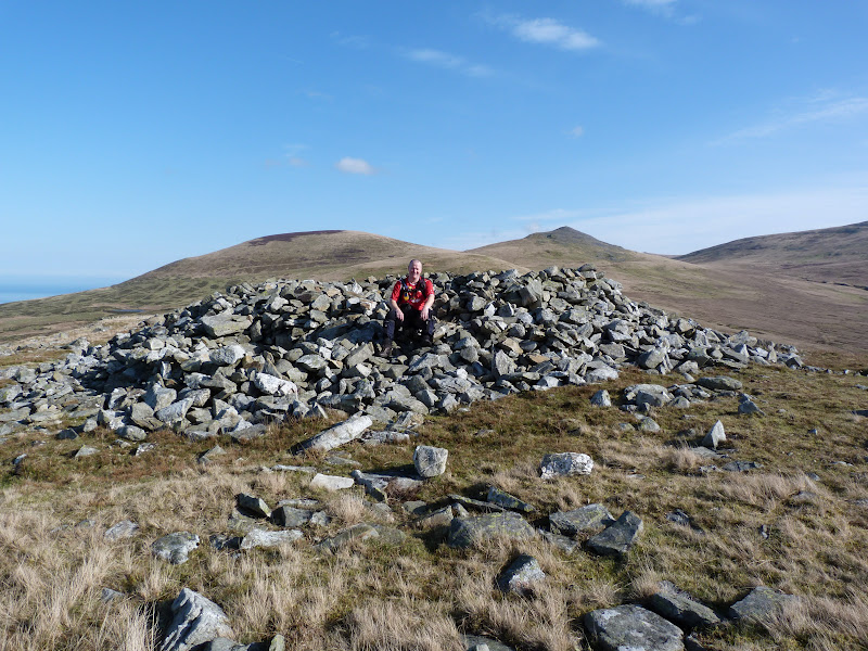
The summit of Moel Faban is soon reached and is littered with the remain's of an ancient settlement.There is a lot of little stone heap's and the remain's of 3 large Bronze Age Cairn's which have been adapted as shelter's.
Warm enough to walk in shirt sleeves we dropped down to Bwlch-ym-Mwhll-le which use to carry water to the Bangor Royal Slate Quarry.
Steeply up to the next top,Lefn,a wlde grassy top with good view's all round.Below is Moel Wnion,left and the rocky top of Gyrn,right.
Looking back in the direction of the Glyderau there was some lovely cloud's above.
We now headed for our third top,Gyrn.The walking in this area is very gentle and the view's amazing but they were about to get better as we gained height on Gyrn as this opened up the view toward's Aber Fall's and Llwytmor.Before we reached the summit i took a photo of a pony crossing in front of us,seen below.
Howie who was a little way back shouted to me to put my hand out,he tried to take a photo of the pony as if it was sitting on my hand,the boy done good.
Just below Gyrn's summit we found this little shelter.
Below the summit of Gyrn and the view toward's,left to right,Llwytmor Bach,Llwytmor,Bera Mawr and Drosgl.
There were quite a few people out walking today taking advantage of the great weather and after having a break at Gyrn's summit we pressed on to Moel Wnion but first we had a mooch around the impressive sheep pen's below Gyrn's summit on it's north side.
A gentle half mile stroll and we reach the summit of Moel Wnion which is marked by a broken trig point in a stone cairn.
Looking across to Llwytmor,Foel Fras and the Bera's.
If there any geo-caches on route i normally go to find them and i knew there was one less than a half mile away in the disused Pantydarren Slate Quarry so i said i would go and grab it.Little did i know it involved dropping down 800 feet to it.I was losing height quickly but the cache wasn't getting any nearer on my GPS so i just kept going because i didn't fancy climbing back up the steep slope.Eventually i reached the cache at the entrance to the disused quarry.
Looking back up to the cave entrance and spoil heap.
The downside of visiting this quarry was the height loss and the long walk back but the upside was the solitude and the brilliant view across to Aber Fall's and Llwytmor.
Locating a path high above the Afon Gam i headed in the direction of Cras and the North Wales LDFP.
I had to walk 2.5 mile with a 700 feet ascent before i reached the boy's who were waiting patiently for me taking in the view across the Menai Strait.I won't be making that mistake again and will only find caches that are on the route.Still the view to Aber Fall's and across to Anglesey was amazing on my return.Below a close up of Castell Beaumaris.
Skirting below Moel Wnion we headed toward's Bryn Hall and it's impressive gateway.
We then took a detour into the Bangor Royal Slate Quarry which used to be called Bryn Hafod-y-Wern to have a look at the launder pillar's.These pillar's supported the water pipe that was brought here from it's source,Cwm Caseg 7 kilometres away !
Returning to the road we passed the quarries flooded pit.Apparently it is 50 metres deep and contain's dumped WW11 unexploded bomb's and barbed wire.Unfortunately a diver died here in the 1970's and his body has not been found.
A gentle stroll across field's lead's into Llanllechid,passing St. Llechid Church.
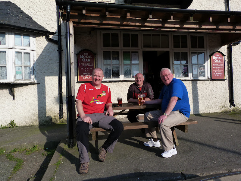
The sun still being very warm we sat outside the Royal Oak in Rachub to digest today's great walk
With my detour i walked a distance of 8.5 miles with 2,300 feet of ascent.
MILEAGE 105.5
ASCENT 26,200
TOPS 33.
FOEL FRAS SUMMIT.
Friday, 9 March 2012
Friday, 24 February 2012
#13.ARAN MOUNTAIN'S LINEAR WALK.23-2-12.
My 13th walk this year proved to be unlucky!.I met Howie at the Rhug Estate at 8.15 and he drove us down to the "Bwlch" where we were to meet Julian at 9 a.m. All the way the weather was horrible,very low cloud and thick fog in places and you couldn't see any of the mountain top's.Julian had got held up in slow moving traffic and didn't arrive until 9.30,he left his car at the "Bwlch" and jumped in with us and we drove back to Llanuwchllyn were we parked in the free car park near the railway station.Setting off at 10 a.m. i joked to the lad's saying "we'll have 10 minutes of view's,7 hour's walking in the cloud and 10 minutes of view's nearing the car",little did i know that that prediction was nearly spot on,if fact it was clear for about 7 minutes,we walked in the mist/fog for 6 and a half hour's and we had about 7 minutes of view's as we neared the car out of our 6 hour 45 minute walk.Turning left out the car park and crossing the B4403 we followed the Afon Twrch to the Hydro-Electric Station.
We were soon in the mist and lost all view's.You couldn't see any rain falling but the mist was carrying very fine water droplet's and i noticed my fleece and trouser's had started to get wet so i suggested a stop to put our wet gear on.The ground under foot was very wet and there was a lot of surface water lying around resulting in numerous detour's trying to find the driest route.Head's down we soon passed Moel Ddu,Craig y Geifr and Moel Ffenigl and hit the steep section that lead's up to the summit of Aran Benllyn.A quick photo at it's summit before we set off for our next top.
Less than 1 mile away and hardly any descent and ascent lies Erw y Ddafad-Ddu and it's splendid summit marker which we didn't linger at as we walked the half mile onto Aran Fawddwy.
Howie and Julian in it's small stone circle.
It had been quite windy all day but it was to increase significantly for the remainder of the walk,and it started to rain quite heavily too resulting in my camera not being employed again on this walk.Breaking new ground we headed down to Waun Camddwr with increasing use of my GPS as i hadn't walked on this section.The ground here is very very boggy and a lot of duck board's have been put down a good few year's ago,some of them have become rotten and it was a squealchy walk over Waun Camddwr to reach the bwlch and the Afon Cywarch.A very steep ascent lead's up to the summit of Glasgwm where it was blowing a hooley,driving the rain horizontally into us.Again not lingering at the summit we made for our 6th and final Nuttall,Pen y Brynfforchog.Again it was a very wet walk to it and we missed the summit by about half a mile before making a detour to it.Just over 1 mile away and virtually all downhill lies the "Bwlch".Again crossing ground i have never been on before i wished it was clear because it looked a lovely area to walk in with what i could see.Locating the fence we started our last steep descent to the car and eventually dropping below the cloud we could see it about 200 metres away.Looking in the direction of Cadair Idris it was a lot brighter and even a patch of blue sky and a sight of the sun,gutted.Gau Graig was visible too.This brilliant walk was 11 mile long with 3,850 feet of ascent and i will definately be walking it again on a clear sunny day.
MILEAGE 97
ASCENT 23,900
TOPS 29.
Wednesday, 22 February 2012
#12.BERWYN'S.
Snow fell locally saturday so i headed for the Berwyn's on monday,not the best day for photography with the skies being leaden but i was hopeful the summit's would be clear.Parking at Llandrillo i headed up the green lane,the 4x4's must have been out recently as the lane was very rutted on the ascent.
Crossing the 2 ford's i turned right at the crossroad's and headed up Moel-Ty-Uchaf to visit it's stone circle.
Re-tracing my step's back to the lane my route took me between the un-named 548 metre top and Moel Pearce and onto Trawsnant.The decent surface of the lane gives way to a rougher surface,rutted by 4x4's and off road biker's and hardened by the recent frost's.
Grassy at first and then turning more heathery as i hit the snow line and my first view of Cadair Bronwen.
At Trawsnant this lane continues to Bwlch Maen Gwynedd but i took the short cut on the minor path that follow's the fence straight up to the summit.Luckily the boggy ground was frozen so no need to do the usual Berwyn bog trot,zig-zagging around,that was to come on the descent.
Looking across to to Cadair Berwyn and Moel Sych.
The wind started to strengthen as i gained height,the last few steep metres a real struggle to stay upright.I eventually reached the stile and crossed it quickly to take a few photo's of the summit marker's atop Cadair Bronwen.
I have never known a winter like it for high wind's in the mountain's and today was no exception,leaving the summit i headed down to Bwlch Maen Gwynedd carefully,it was very slippery on and off the duck board's.
At the bwlch i took a detour to visit the standing stone between Tomle and Cadair Berwyn,this stone was re-erected by "High Sports" in 2008.Below you can just see the stone on the horizon left of centre at the end of this rutted footpath.Here i was sheltered from the high wind thankfully.
My trekking poles resting against the stone to show it's height.
Great view of Craig Berwyn from here.
Re-joining the main path from Cadair Bronwen i was once more exposed to the ferocious wind.It was blowing right to left and trying hard to force me off the cliff's which were to my left,it was a real struggle to stay away from the edge.I eventually reached the trig point and struggled to take a few photo's.
200 metres south of the trig point and 10 feet higher is the north top of Cadair Berwyn but i didn't visit this summit due to the high wind's,i just wanted to get off this summit as quickly as possible.Heading west over the stile i made my way down Foel Fawr,the wind easing as i quickly lost height.Below looking down on Pennant.
Below the snow line the thaw had set in and it was a boggy descent all the way back to Llandrillo.On my map i saw there was a cairn on Pennant so made a small detour off the path to visit it,i was impressed by the size of it.
My route now was to cross the Nant Cwm Tywyll,seen below,and head across to the Afon Clochnant.At least i was sheltered from the wind here and was able to take my hat and coat off.
The camera stayed away as this was the most boggiest section on the walk.I had to zig-zag up and down in a few places to cross the small stream's below Carnedd y Ci,in fact the whole area was just like a giant wet sponge.I was so glad when i reached the decent track above Blaen-y-dre.
At the fork i took the left hand lane,as i had walked the right hand lane previously.
Some impressive sheep in the field's.
Dropping down into Llandrillo i walked past the impressive Llandrillo Hall and back to the car park.Today's walk was 11.5 mile in length with 2,900 feet of ascent.
MILEAGE 86
ASCENT 20,050
TOPS 23.
Monday, 13 February 2012
#11.MOEL-Y-GEST.12-2-12.
Today's forecast was for a dry misty day so i decided to climb Moel-y-Gest.I failed on my first attempt of this mountain in 1990 when we were staying at Greenacres Caravan Park,not having a map and unable to find a route to the summit.With the travelodge being on the A497 i had noticed a footpath opposite the petrol station and a quick look at my map looked like there would be a route to the summit off it.We checked out of the lodge and put our bag's in the car and left the car where it was and made the short walk to this footpath,a Buzzard sitting atop the lamp post seemed unbothered by our presence.
The path lead's steeply up through a small wood at first.
Eventually popping out into the open we got a misty view down upon Porthmadog.
Just 1 mile from the summit but as we gained height the view's disappeared in the gloom.I didn't get any decent shot's until we reached the summit trig point.
Distance walked today was 2.5 miles with 1,000 feet of ascent.
MILEAGE 74.5
ASCENT 17,150
TOPS 21.
The path lead's steeply up through a small wood at first.
Eventually popping out into the open we got a misty view down upon Porthmadog.
Just 1 mile from the summit but as we gained height the view's disappeared in the gloom.I didn't get any decent shot's until we reached the summit trig point.
Distance walked today was 2.5 miles with 1,000 feet of ascent.
MILEAGE 74.5
ASCENT 17,150
TOPS 21.
Subscribe to:
Posts (Atom)