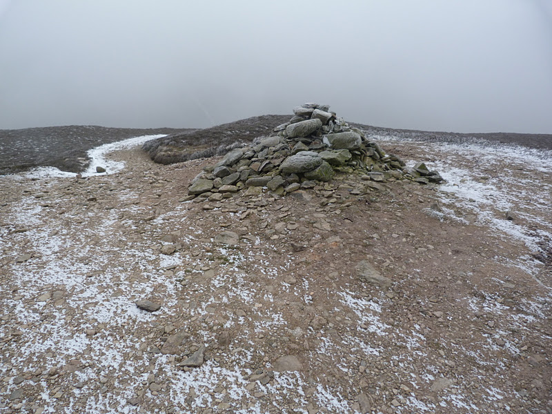
FOEL FRAS SUMMIT.
Monday, 6 February 2012
#9.FRONCYSYLLTE-LLANGOLLEN LOOP.5-2-12.
Me and Julie were supposed to meet Julian and Deb in a lay-by near Tyn-y-Ffridd to walk a circuit in the Berwyn's taking in 10 Nuttall's at 9 a.m. We set off at 8 o'clock on a quite mild morning (plus 3 degree's),the first time the temperature has been above freezing at night for a week.The A483 and the A5 were fine,no sign of any ice or snow but as soon as we got on the B4500 and headed up the Ceiriog Valley we noticed the deterioration in condition's,there were some nasty patches of ice and i had to slow down considerably.There was a little bit of grit lying on the road but i think that was from a few night's ago.We got to Llanarmon Dyffryn Ceiriog at 8.40 and headed up the lane beside the Hand Hotel and immediately hit sheet ice,slowing down and in second gear we carried on but as soon as we got to Grid Ref 158 318 the road steepened on the bend and i ground to a halt (0.25 miles from our rendezvous),i made a few attempt's but with wheel's spinning i stated to slide into the ditch so i rolled back down to a flat section.Looking at my map there was another lane near the hotel that lead's to Oswestry so we tried that one.Passing the hotel and then the church the road rose steeply and i decided against it with it too being very icy.Returning to the village i tried phoning Julian,no signal,Julie tried on her 2 phones and still no signal.I drove back along the B4500 and we got a signal in Glyn Ceiriog so i pulled over and phoned Julian.It went to voice mail so left a message and i texted him to say we wouldn't be making it as it was now after 9 o'clock and it would take us 1 hour to get there via Oswestry.I decided to do a walk around Llangollen so set off along the A5 when my phone rang,i pulled over and it was Julian.He told me he had made the car park on equally treacherous road's and realised we weren't going to make it so he was heading back too,so i arranged to meet him in Chirk and to take them on our favourite Froncysyllte walk.Parking near the aqueduct it was 10.20 a.m. by the time we set off.We crossed the canal and headed out of Trevor across field's which were very hard under foot with all the recent frost's we had had.We crossed the A539 and entered the wood near Trevor Hall on the Offa's Dyke foot path.
Leaving the tree's we were now out onto the rock's looking down on the Vale of Llangollen.
We walked down the "Panorama" and paid a visit to the disused limestone quarry,i abseiled here year's ago.
Returning to the road we next paid a visit to Castell Dinas Bran.
We walked down past the school to picked the canal up for our return leg.
We left the canal near Plas-yn-pentre and walked past some lovely looking properties.The Old Mill.
Another old mill on the Dee.
Crossing the river on the old stone bridge we walked up to the canal and across the aqueduct.
Me,Julian and Deb messing around.
Today we walked 10.5 miles with 2,100 feet of ascent.We were so glad we eventually met up with our very good friend's and were able to walk together,even though it wasn't the walk we had planned.
MILEAGE 68.5
ASCENT 14,650
TOPS 20.
Wednesday, 1 February 2012
#8.PEN-Y-LLAN-GWR.1-2-12.
A short walk this morning on a very frosty sunny day saw me and Clive parking at the Blue Bell,Ffrith and doing a shortened route up to Pen-y-Llan-gwr.Leaving the pub car park we took a minor path across the dis-used railway line to reach a green lane that brought us out near the Cae-ap-Edward farm.
A short walk along this road and we then went left up a small track near to this shelter.
This track open's out into the field's that lead's to Pen-y-Llan-gwr.
The path now enter's the Nant y Ffrith Wood's.
A short walk through the wood and we soon saw the trig point on top of Pen-y-Llan-gwr.
Me at the trig point.
Leaving Pen-y-Llan-gwr we headed down through the tree's to visit the old stone bridge above the Afon Nant y Ffrith.
We then went to see where the Nant y Ffrith Hall use to stand and what's left of it's ornamental garden's.
We followed the path along side the river all the way back to Ffrith.I was dismayed to see it had deteriorated badly in the 12 month's since i last walked it,badly eroded by mountain bikes.We walked under the railway viaduct to arrive back at the pub car park.
The distance walked today was 4 miles with 1,000 feet of ascent.
MILEAGE 58
ASCENT 12,550
TOPS 19.
Tuesday, 31 January 2012
#7.LLANTYSILIO MOUNTAINS from the PONDEROSA.31-1-12.
A short walk today starting from the Ponderosa and taking in the 4 top's of the Llantysilio Mountain's.The temperature was minus 2 degree's celcius and misty as i left the car with a little bit of snow on the ground.
It only took me 15 minutes to reach the unmarked summit of Moel y Faen seen below.
Next up was Moel y Gamelin about 1 mile away which i reached in 20 minutes.The high point today at 1,983 feet tall.
Not hanging around at the summit as the view's were non existant and it was bitterly cold in the wind i set off to Moel y Gaer,seen below,down the horrible scree slope made worse today with the snow and ice.I reached the summit in 20 minutes.
Next up is the fourth summit of Moel Morfydd which i reached in 15 minutes.It had only taken me 1 hour and 10 minutes to reach the trig point on Moel Morfydd,a distance of 2.7 miles but a quick time considering the condition's.
I retraced my step's over the iron age hillfort of Moel y Gaer to the bwlch where the Clwydian Way crosses it,seen below.
I now headed north contouring below Gribin Oernant and came across this old car seat at the side of the path.
On reaching the boundary wall of the Plas-yn-Rhos farm i headed east past the disused quarry.
Leaving the field i reached the minor road near Plas Norway.
This left me with a 1 mile walk back to my car.A distance of 6 mile was walked with 1,800 feet of ascent.
MILEAGE 54
ASCENT 11,550
TOP 18.
Monday, 30 January 2012
#6.DOVEDALE VALLEY,DERBYSHIRE.29-1-12.
A walking forum meet was arranged and as Julie was feeling a little bit better we added our names to attend and we met the other 29 member's in the village of Thorpe.A lot of people that we hadn't previously met were in attendance as well as some very good friend's that we have known for a long time.Micky was leading the walk and we set off on a very cold,dank dreary day.
We soon left the village and were out into the field's and our first view of Thorpe Cloud,right.
Overnight there had been a heavy frost and with the temperature rising slightly the ground had softened and with the field's being muddy the mud was sticking to our boot's in big lump's.
Below the entrance to the Dovedale valley with Thorpe Cloud right and Bunster Hill left.
Back onto the road we crossed over the River Dove and left Derbyshire and entered Staffordshire.
Back into more muddy field's with a good view to a distant Thorpe Cloud.
There now involved a steep slippery pull up to a col on the side of Bunster Hill and the group started to spread out.Below is some of the group taking a breather at the col.
The village of Ilam.
Leaving the col we hit a very tricky traverse on exposed slippery limestone and a very muddy path.A few of the females were struggling but the male member's helped them out and eventually we all got over it.
More cloying muddy field's led to a short stretch of road work before we went into another stretch of muddy field's before we eventually reached the village of Wetton were we had our dinner break.We passed the "Old Police House" which had some stock's in the front garden,Howie couldn't resist trying them out.
There is a lot of dry stone wall's in the area with narrow gap's for the footpath's to pass through,every time the group reached one there became a long wait as we all squeezed through.
The next village we past through was Alstonefield and it's little Well.
A few member's decided to have a pint in the local pub and as the group were not going through the Dovedale Valley me,Julie and Howie left them and walked through this delightful valley following the River Dove.On our way to Milldale we saw a hot air balloon hovering low over the misty valley.
Milldale bridge.
Below are a series of photo's along the river path that we followed for 3 miles back to the foot of Thorpe Cloud.
Howie had been feeling unwell all day but had worsened in the last hour so he took the shortened route along the Lin Valley back to the car whilst me and Julie ascended the shapely Thorpe Cloud.
A slippery descent down to the Lin Valley and a short walk back to Thorpe were we arrived at the same time as the other's.We drove to the village of Fenny Bentley for a drink before Howie drove us home.We walked a distance of 12 miles with 2,100 feet of ascent.
MILEAGE 48
ASCENT 9,760
TOPS 14.
Subscribe to:
Posts (Atom)