Today's walk saw me return quickly to the Glyderau with Glyno to take in Y Garn via the little walked "sheep path",Foel-goch and returning via a path neither of us had walked.I have noticed 2 stile's at Bwlch y Brecan that lead in the direction of the A5 in the past but don't know anybody who has walked them,and a while back Glyno was talking to the Ogwen Cottage warden who described the path so we decided to try to find it and use it as our route back to the car park.
The weather forecast was for a cloudy start with rain shower's but to improve by dinner time,so ideally we would have liked to have started out late but we both needed to be back home handy so an early start was arranged.We started walking at 8.45am and looking up to the mountain top's it didn't look to bad,although the skies were grey most of the top's were clear.Below is Foel-goch and the new footbridge at the outflow of Llyn Idwal.
Unfortunately the condition's soon got worse and the mist covered the mountain top's and it started to rain,the Devil's Kitchen looking menacing.
As we rounded the lake via the west bank the rain got heavier so the wet coat's were donned.The rain made the rock's very slippery so great care was needed.We soon made the bottom of the large cleft and we broke away from the main path to locate the sheep path.
I cut across looking for the path to soon which left us with a tricky scramble up to it,it would have been easy in dry condition's but with the rock's being wet it was quite difficult.Here's Glyno finishing it.
After this little scramble it was a straight forward walk up the track.
Looking down to Llyn Idwal.
The scramble was soon over and we gained the main path up from Llyn y Cwn to the top of Y Garn.
It was cold and wet at the summit so we didn't hang around and we set off for Foel-goch.It is over 1 mile away but we walked it in 20 minute's again not lingering at the summit as the mist stopped us having any view,quickly down to Bwlch y Brecan via the slippery,steep scree path to locate the second stile (nearest Mynydd Perfedd).Stepping over it we were surprised to see that there was a very well walked path leading to Y Galan,and happily the weather started to improve as well.We were sheltered from the wind as we descended lower,the rain stopped and the sun came out,happy day's.The view's all around were brilliant,and improving all the time as the weather improved.
Once we found the "shepherd's path" we set off on the return journey.The next few photo's are taken from this path on our return.
We stopped for lunch below Y Llymllwyd,the view to Tryfan and the Ogwen Valley was amazing.We could now see the scout hut,Y Hafod,that i stayed at on a forum meet up.
This path stay's very nearly at the same contour for over 1.5 miles heading for the wall in the distance.
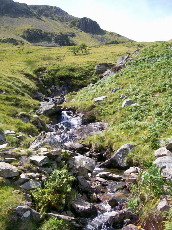
On reaching said wall a stream run's down from Llyn Cywion,here we had 2 option's,the first to follow the wall back to Cwm Idwal or the second to follow the stream down to Y Hafod,we choose the later as i wanted to show Glyno the tank trap's in the valley.This was a wise choice as the faint path that stay's close to the stream revealled some lovely little waterfall's on the descent.
Last view of the Ogwen Valley before we got to low.
Nearing Y Hafod.
Friendly ponies.
The tank trap's and a distant Foel-goch.
Today's great walk was 6.5 miles long with 2,800 feet of ascent.
MILEAGE 283.5
ASCENT 69,350
TOPS 76.