FOEL FRAS SUMMIT.

Monday, 30 January 2012
#6.DOVEDALE VALLEY,DERBYSHIRE.29-1-12.
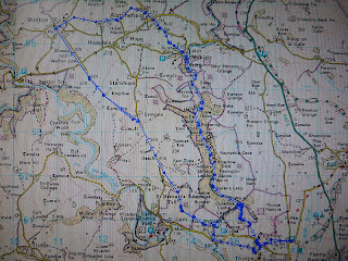
A walking forum meet was arranged and as Julie was feeling a little bit better we added our names to attend and we met the other 29 member's in the village of Thorpe.A lot of people that we hadn't previously met were in attendance as well as some very good friend's that we have known for a long time.Micky was leading the walk and we set off on a very cold,dank dreary day.
We soon left the village and were out into the field's and our first view of Thorpe Cloud,right.
Overnight there had been a heavy frost and with the temperature rising slightly the ground had softened and with the field's being muddy the mud was sticking to our boot's in big lump's.
Below the entrance to the Dovedale valley with Thorpe Cloud right and Bunster Hill left.
Back onto the road we crossed over the River Dove and left Derbyshire and entered Staffordshire.
Back into more muddy field's with a good view to a distant Thorpe Cloud.
There now involved a steep slippery pull up to a col on the side of Bunster Hill and the group started to spread out.Below is some of the group taking a breather at the col.
The village of Ilam.
Leaving the col we hit a very tricky traverse on exposed slippery limestone and a very muddy path.A few of the females were struggling but the male member's helped them out and eventually we all got over it.
More cloying muddy field's led to a short stretch of road work before we went into another stretch of muddy field's before we eventually reached the village of Wetton were we had our dinner break.We passed the "Old Police House" which had some stock's in the front garden,Howie couldn't resist trying them out.
There is a lot of dry stone wall's in the area with narrow gap's for the footpath's to pass through,every time the group reached one there became a long wait as we all squeezed through.
The next village we past through was Alstonefield and it's little Well.
A few member's decided to have a pint in the local pub and as the group were not going through the Dovedale Valley me,Julie and Howie left them and walked through this delightful valley following the River Dove.On our way to Milldale we saw a hot air balloon hovering low over the misty valley.
Milldale bridge.
Below are a series of photo's along the river path that we followed for 3 miles back to the foot of Thorpe Cloud.
Howie had been feeling unwell all day but had worsened in the last hour so he took the shortened route along the Lin Valley back to the car whilst me and Julie ascended the shapely Thorpe Cloud.
A slippery descent down to the Lin Valley and a short walk back to Thorpe were we arrived at the same time as the other's.We drove to the village of Fenny Bentley for a drink before Howie drove us home.We walked a distance of 12 miles with 2,100 feet of ascent.
MILEAGE 48
ASCENT 9,760
TOPS 14.
Subscribe to:
Post Comments (Atom)


No comments:
Post a Comment