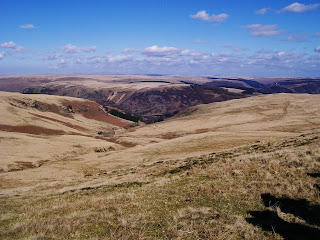
These are 2 Nuttalls that Howie needed to knock off his list so he put it up as a "meet up" on the walking forum to see if anybody wanted to join us and we had a nice little walking party that consisted of me,Julie,Howie,Joester,Abs and their 3 lovely daughter's Chloe,Poppy and Bea,Yamyam,Sharon,Jim,Janine,Paul,Theresa and their dog Sweep.The weather forecast was for an overnight frost followed by a sunny day.
Howie picked us up at 7a.m. and we made the 70 mile journey to Rhayader in 1 hour 30 minute's.We stopped at the Caban Coch reservoir dam to take a few photo's as it was a lovely sunny morning.
We then drove the short distance to the adjacent reservoir,Carreg-ddu and stopped for a few photo's again.These 2 dam's are separated by a submerged dam topped with a road bridge.Water is taken out at the Foel Tower and it flow's by gravity all the way to Birmingham 73 miles away.
We drove across the bridge and made our way to the car park at Llanerch Cawr,this is only a small car park and when we got there is was being used to store timber from some recent tree felling.We managed to squeeze all 4 car's on in one corner,Paul had parked a short distance away.Before we set off Abs and little Bea gave me a present.I opened it to reveal a knitted hat of a Welsh Dragon,i was well chuffed and wore it all day.
We crossed the Afon Claerddu on the new bridge which stand's beside's it's predecessor,seen below.
We followed the quarry track which crosses the Afon Marchnant.This rise's gently but gave us some nice view's back to the reservoir.
After 1 mile and 400 feet of ascent we reached the disused quarry.Stone from here was used to construct the 184 foot curved dam of the Claerwen reservoir that took 6 year's to construct.
Poppy and Chloe were keeping me entertained playing guessing game's and i-spy as we walked.We now walked out onto the open moorland,the path was vague as not many people visit these hill's but the view's were good.
From the quarry it is just over 1 mile with another 800 feet of ascent to the summit of Gorllwyn.We rested by the cairn and wind shelter whilst a few other's walked the 300 metres north east to the OS trig point and hollowed out ancient cairn.
We could see the massive cairn's on Drygarn Fawr,3.8 mile's away in the distance but the terrain in between consisted of boggy ground,tussocky grass,hidden hole's and vague track's to follow.Apparently Victorian visitor's gave this area the nickname of "The Desert of Wales" !,i can see why.The term describes to the large area in Central Wales in the Cambrian Mountains known locally as "Elynydd" and got the moniker through the lack of road's and town's.
After crossing the Bwlch y Ddau Faen we walked the last 400 feet of ascent up to the impressive beehive cairn's on top of Drygarn Fawr.In English it translate's to 3 large cairn,s but there are only 2 cairn's here?.The origin's of these cairn's are a mystery.They were built sufficiently long ago for much local knowledge to have been lost.The stone's themselves are from the original Bronze Age cairn's built between 2000 and 1500 BC.A cairn on Drygarn Fawr,which was used as a trigonometrical station in 1851,was rebuilt in 1884 to commemorate the original one,but this was not used again by the OS as their concrete pillar was erected in 1936.The cairn's were repaired in 1920.
We headed north down to the Pant Glas and followed the Afon Rhiwnant.Again here the terrain is awful and it takes a long time to go a short way,but it is a pretty valley.
When me and Julie last did this walk 2 year's ago she had a nasty fall as we made one of the many river crossing's,slipping on some wet rock's.As we carefully crossed the stream under Dalrhiw Sharon slipped and fell in the shallow stream banging her elbow and hurting her hip and back.After a bit of cleaning up she was ok to carry on so i carried her bag for a while.At the difficult crossing where the Nant Paradwys meet's the Rhiwnant i was helping everybody cross,Theresa slipped and fell in.She got a lot wetter than Sharon but wasn't hurt as much,just broke one of her trekking poles.Once across this section it is a pleasant walk back to the car's.Here are a few photo's below.
Although we only walked 10 mile with 1850 feet of ascent,visiting 2 summit's,this was a bloody hard walk and took us nigh on 8 hour's.A great effort by everybody to get round,especially Poppy and Chloe who didn't moan once on the entire walk,although they very nearly talked me to death.A de-briefing in the Elan Hotel in Rhayader before everybody said there farewell's.Fantastic company to walk with.
MILEAGE 141.5
ASCENT 36,150
TOPS 44.


No comments:
Post a Comment