Today's walk came from the "Rural walks in Flintshire" booklet again.This was a last minute decision as Julie was working until 3P.M. and when she got home i said "get your boot's were going for a walk",15 minutes later we were getting them on in the car park at the top of Tinkersdale in Hawarden.The booklet suggest's going across the golf course but as it was a lovely sunny afternoon i assumed there would be a few golfer's out so we left this section out and walked south on the A550 until we came to a lane on our left hand side about half way down the road,we turned off the A550 up this lane until it peter's out at the fence by the A55.
We turned left through the staggered entrance and walked down the old road until we reached the village of Warren
.Just after passing the Spinning Wheel Inn we turned left onto a lane marked Cherry Orchard Farm.We crossed a cattle grid and passed the entrance to Cherry Orchard House and continued down this quiet lane.
Here there are some far reaching view's to the east looking across the Cheshire Plain,and the eyesore that is the Airbus Factory at Broughton,(my father worked here for over 25 year's until retirement and my brother Konrad has been employed there for nearly 40 year's!).
Continuing down the lane we could see the ruined Hawarden Old Castle in the ground's of the Hawarden estate.This ruin was built in the 13th century and was used by Edward 1st as a base for his invasion of Wales.It was captured by Dafydd,brother of Welsh Prince,Llewelyn ap Gruffudd,in 1282.Good old Daf,if he was alive today i would buy him a pint.In the 17th century it suffered severe damage during the Civil War when it was defended by the Parliamentary side.
The path now enter's Bilberry Wood and is waymarked.After a short distance we got a glimpse of the "New" Castle.Here 4 time's Prime Minister of Britain William E Gladstone use to live after his marriage to Catherine Glynne,heiress to the Hawarden Estate.The family still live here.
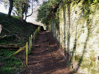
The path follow's a wall through the wood and eventually you reach the ruined 18th century corn mill.The mill wheel and much of the machinery still remain's.
A short walk brought us back to the car park.The distance was 3.5 miles with 250 feet of ascent.
MILEAGE 145
ASCENT 36,400
TOPS 44.


No comments:
Post a Comment