Me and Julie spent the weekend in York and on the sunday we walked the city walls.Parking in the St. George's Field car park below the Skeldergate Bridge which span's the River Ouse.It was a beautiful sunny morning but quite cold being only 8 degree's
Crossing the bridge we climbed up onto the wall's via the Bishop Gate.
Somebody had placed a few geo-caches on the wall's so i picked these up as we walked around.With it being a gorgeous morning the wall's were very busy so stealth was required to grab the caches.
Micklegate Bar below.A bar is an entrance into the city.
York Minster now comes into view.
We now crossed the Lendal Bridge.
By now my memory card was full so we made a detour into town to find a camera shop to buy a new one,taking in a few of the sight's along the way back to the wall.The Shambles below.
The Minster.
Clifford's Tower.
The tower's very efficient grass cutter's.
Returning to the car we drove 15 miles to Knaresbrough to visit Mother Shipton's Caves.I looked at their website to find the postcode but didn't look at the opening times,i assumed it was open all year round,it shut's for November,December and January,doh.Oh well we had a walk along the River Nidd and visited the castle in this beautiful town.
8 miles were walked with a total of 500 of ascent.
MILEAGE 412.5
ASCENT 101,150
TOPS 99.
FOEL FRAS SUMMIT.
Monday, 7 November 2011
Wednesday, 2 November 2011
#57.CASTELL DINAS BRAN.30-10-11.
With the Essex girl's stopping a second night me and Julie had arranged to meet them in Llangollen on a glorious sunny calm day,we were going to assess Donna's injury and see if they fancied a walk locally.Donna said she felt a bit sore but wanted to try another walk.Sioban had made many journey's to Snowdonia down the year's and had alway's wanted to climb up to Castell Dinas Bran so this is what we decided on.Parking in the main car park in the town centre we walked across the River Dee and took the path that run's along side Ysgol Dinas Bran.It was really warm today and we walked at a gentle pace having lot's of stop's to take in the view's and for them to take photo's.Donna did well and we were soon at the castle were we had a good look around.
I took them down the north side toward's the Eglwyseg before picking up the lane that lead's back down to the town.Taking the second footpath sigh we entered the field's where the path goes through a farm before dropping down to the Llangollen Canal.
A nice gentle stroll brought us back into the town where Rich and Eva were waiting for us.We said our goodbyes before we headed for a sunday roast to the White Water Hotel.
We walked 4 mile with 1,200 feet of ascent.
MILEAGE 404.5
ASCENT 100,650
TOPS 99.
I took them down the north side toward's the Eglwyseg before picking up the lane that lead's back down to the town.Taking the second footpath sigh we entered the field's where the path goes through a farm before dropping down to the Llangollen Canal.
A nice gentle stroll brought us back into the town where Rich and Eva were waiting for us.We said our goodbyes before we headed for a sunday roast to the White Water Hotel.
We walked 4 mile with 1,200 feet of ascent.
MILEAGE 404.5
ASCENT 100,650
TOPS 99.
#56.LLWYTMOR and LLWYTMOR BACH.29-10-11.
I had organised a forum meet up in the Northern Carneddau and we had a decent attendance of 15 member's.The forecast was for a sunny morning but clouding over bringing light rain,turning heavier in the afternoon and with wind's of up to 40-50 mph.
I had arranged to car share with Julian and Deb so had made them a bacon toastie and cup of tea on their arrival.After breakfast we set off in Julian's car for the journey to Aber Fall's.It was a beautiful clear morning with a stunning sunrise but on approaching Llandudno it got cloudier and we were hit with a massive shower of rain.It didn't last long and we arrived at the Bont Newydd car park in glorious sunshine.
The other walker's turned up with the exception of the Essex girl's who had stayed overnight in the Oswestry Travel lodge,a text from Donna confirmed they were on their way but had been held up by an overturned lorry.
Our 9 a.m. meet time came and went so i went to find the nearby geo-cache and grab some photo's.
It was just after 10 a.m. when they arrived and 10.15 by the time we set off along the Afon Goch.
The pace was good on the easy path up to the fall's.
I tried to take another photo and my camera packed in,i went through the menu to see if anything was out of place but i think that it has just died through over use,never mind i have had it for a long time and took hundred's of photo's,time for a new one me think's.
After a visit to the bottom of the fall's we headed up the scree path that lead's to the top of the fall's.Safely negotiating the slippery rock's we reached the top of the fall's in good time,i noticed that Donna had slowed up but Howie was accompanying her.The weather ahead looked foul,dark cloud's,and the wind started to pick up.Stopping by the sheep fold to wait for Donna and Howie a few spot's of rain started to fall so we donned our wet gear.Still following the Afon Goch Donna and Howie fell back again so i suggested a break behind some big rock's the afforded us some shelter.
We had walked 2.5 miles in 4 hour's and i was concerned we wouldn't complete the circuit i had proposed so suggested a shortened route.I know some people were disappointed but the pace was very very slow.Moving again the walk steepen's sharply as it head's directly for the summit of Llwytmor.in 0.8 of a mile it climb's 1,170 feet.The wind was getting stronger by the minute and the team was really spread out now.Again Donna dropped back struggling with the steepness of the mountain,Sioban and Deb now staying with them and me and Julie about 50 metres away.When we looked down to them we saw that Donna was sitting down,we wondered if she had injured herself as the wind was making it difficult to cross the rock's,Julie had been blown over a couple of times.Dennis came down to us and then went down to see if Donna was alright.Howie and Sioban had come up to us to say that Donna had cramps and couldn't go any further.It was decided that Howie would take Donna,Deb and Dennis down and i would collect the other's and bring them down via Llwytmor Bach.So me,Julie and Sioban carefully ascended in the strongest wind i have walked in in year's.We had to crouch down and virtually walk on all four's to progress higher,nearing the summit shelter i sent Julie and Sioban to the col whilst i went to the shelter to relay the message about the other's,i told them my plan's and they were all in agreement and we left the safety of the shelter to meet Julie and Sioban at the col.We still had good view's,the rain was only light but i reckon the wind's were approx. 70-80 mph.Great care was needed leaving Llwytmor as it is a very rocky mountain but we safely reached the grassy saddle and made our way to Llwymor Bach.Here we had another break before descending down to the forest.We found a bit of shelter from the wind here but the rain became really heavy now as we entered the forest and made our way back to the car park.A fast pace down saw us arrive at the car park 10 minutes after the other's where we quickly changed and made our way to the Gladstone Hotel in Dwygyfychi for beer,a chat and a warm.Donna was feeling embarrassed but a lot better but everybody said they had enjoyed the day,especially battling against the wind.In total we walked 7 miles with 2,650 feet of ascent.
MILEAGE 400.5
ASCENT 99.450
TOPS 97.
I had arranged to car share with Julian and Deb so had made them a bacon toastie and cup of tea on their arrival.After breakfast we set off in Julian's car for the journey to Aber Fall's.It was a beautiful clear morning with a stunning sunrise but on approaching Llandudno it got cloudier and we were hit with a massive shower of rain.It didn't last long and we arrived at the Bont Newydd car park in glorious sunshine.
The other walker's turned up with the exception of the Essex girl's who had stayed overnight in the Oswestry Travel lodge,a text from Donna confirmed they were on their way but had been held up by an overturned lorry.
Our 9 a.m. meet time came and went so i went to find the nearby geo-cache and grab some photo's.
It was just after 10 a.m. when they arrived and 10.15 by the time we set off along the Afon Goch.
The pace was good on the easy path up to the fall's.
I tried to take another photo and my camera packed in,i went through the menu to see if anything was out of place but i think that it has just died through over use,never mind i have had it for a long time and took hundred's of photo's,time for a new one me think's.
After a visit to the bottom of the fall's we headed up the scree path that lead's to the top of the fall's.Safely negotiating the slippery rock's we reached the top of the fall's in good time,i noticed that Donna had slowed up but Howie was accompanying her.The weather ahead looked foul,dark cloud's,and the wind started to pick up.Stopping by the sheep fold to wait for Donna and Howie a few spot's of rain started to fall so we donned our wet gear.Still following the Afon Goch Donna and Howie fell back again so i suggested a break behind some big rock's the afforded us some shelter.
We had walked 2.5 miles in 4 hour's and i was concerned we wouldn't complete the circuit i had proposed so suggested a shortened route.I know some people were disappointed but the pace was very very slow.Moving again the walk steepen's sharply as it head's directly for the summit of Llwytmor.in 0.8 of a mile it climb's 1,170 feet.The wind was getting stronger by the minute and the team was really spread out now.Again Donna dropped back struggling with the steepness of the mountain,Sioban and Deb now staying with them and me and Julie about 50 metres away.When we looked down to them we saw that Donna was sitting down,we wondered if she had injured herself as the wind was making it difficult to cross the rock's,Julie had been blown over a couple of times.Dennis came down to us and then went down to see if Donna was alright.Howie and Sioban had come up to us to say that Donna had cramps and couldn't go any further.It was decided that Howie would take Donna,Deb and Dennis down and i would collect the other's and bring them down via Llwytmor Bach.So me,Julie and Sioban carefully ascended in the strongest wind i have walked in in year's.We had to crouch down and virtually walk on all four's to progress higher,nearing the summit shelter i sent Julie and Sioban to the col whilst i went to the shelter to relay the message about the other's,i told them my plan's and they were all in agreement and we left the safety of the shelter to meet Julie and Sioban at the col.We still had good view's,the rain was only light but i reckon the wind's were approx. 70-80 mph.Great care was needed leaving Llwytmor as it is a very rocky mountain but we safely reached the grassy saddle and made our way to Llwymor Bach.Here we had another break before descending down to the forest.We found a bit of shelter from the wind here but the rain became really heavy now as we entered the forest and made our way back to the car park.A fast pace down saw us arrive at the car park 10 minutes after the other's where we quickly changed and made our way to the Gladstone Hotel in Dwygyfychi for beer,a chat and a warm.Donna was feeling embarrassed but a lot better but everybody said they had enjoyed the day,especially battling against the wind.In total we walked 7 miles with 2,650 feet of ascent.
MILEAGE 400.5
ASCENT 99.450
TOPS 97.
Friday, 21 October 2011
#55.KENTMERE WALK.20-10-11.
A trip to the Lake District was organised and saw me,Howie and Killy meeting Micky in the beautiful village of Kentmere.We parked near the church on a very frosty,freezing cold but sunny morning.
We left the village walking past "The Nook" and below Ewe Crags heading up the Garburn Pass.It was like walking on a dried up river bed,a horrible ascent over loose stone.
At the top of the pass we got a distant view across to Raven Crag and Red Screes.
And down to a cloud inversion over Windermere.
We now turned right and the path ran below Buck Crag on it's way to Yoke.It was very warm now in the sun but the cloud's were rolling in from the coast and looked like they were bringing rain with them.At least the path improved.
Summit pose.
The cloud quickly reached us bringing some light drizzle and low cloud so we donned our wet gear as we left the summit.It is a short walk to the next mountain Ill Bell and we were soon at it's summit.
A long way below us lay the Kentmere Reservoir.The cloud blurring the view.
Next up was our third Nuttall,Froswick,again a short walk away.The rain had stopped and the cloud was dispersing.
A happy chappy at the summit of Froswick.
We headed for the course of the old Roman road on our way to Thornthwaite Crag in ever improving weather.
Just as we reached the impressive beacon that mark's the summit it started to cloud over again.
After having dinner here we headed for High Street about 1 mile away.
Micky suggested walking over Mardale Ill Bell and the Nan Bield Pass but i wanted to follow the route i had in my GPS and out of the Nuttall's Book that took in Rough Crag and after much debate we headed for Rough Crag as the weather worsened,the rain getting quite heavy and low cloud again descending upon us.
So we dropped down Riggindale Crag to pick up Rough Crag.
The plan was to walk down to Blea Water,pictured below.
But i was over-ruled and the gang decided to walk down Dudderwick to reach Haweswater Reservoir.
The Rigg.
Here we then walked up the steep path to the top of Gatescarth Pass where we should have ascended Harter Fell but again the group didn't fancy it and the decision was made to walk down the Long Sleddale Valley.
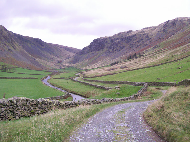
Although the rain had stopped a very cold wind was blowing up the valley into our faces.This 2 mile trek was down on the worst terrain of the day,horrible inverted stones layed for a track and very wet with the recent rain.I slipped on a section and really hurt my knee,i was not a happy bunny.Although it's a beautiful valley i did not enjoy walking it.
Eventually we reached Sadgill and crossed the River Sprint and took the path behind this farm.
2 mile later we arrived at Stile End to eventually reach Kentmere and a great view back up the valley.Today's walk was 15 miles long with 5,000 feet of ascent taking in 6 top's.
We left the village walking past "The Nook" and below Ewe Crags heading up the Garburn Pass.It was like walking on a dried up river bed,a horrible ascent over loose stone.
At the top of the pass we got a distant view across to Raven Crag and Red Screes.
And down to a cloud inversion over Windermere.
We now turned right and the path ran below Buck Crag on it's way to Yoke.It was very warm now in the sun but the cloud's were rolling in from the coast and looked like they were bringing rain with them.At least the path improved.
Summit pose.
The cloud quickly reached us bringing some light drizzle and low cloud so we donned our wet gear as we left the summit.It is a short walk to the next mountain Ill Bell and we were soon at it's summit.
A long way below us lay the Kentmere Reservoir.The cloud blurring the view.
Next up was our third Nuttall,Froswick,again a short walk away.The rain had stopped and the cloud was dispersing.
A happy chappy at the summit of Froswick.
We headed for the course of the old Roman road on our way to Thornthwaite Crag in ever improving weather.
Just as we reached the impressive beacon that mark's the summit it started to cloud over again.
After having dinner here we headed for High Street about 1 mile away.
Micky suggested walking over Mardale Ill Bell and the Nan Bield Pass but i wanted to follow the route i had in my GPS and out of the Nuttall's Book that took in Rough Crag and after much debate we headed for Rough Crag as the weather worsened,the rain getting quite heavy and low cloud again descending upon us.
So we dropped down Riggindale Crag to pick up Rough Crag.
The plan was to walk down to Blea Water,pictured below.
But i was over-ruled and the gang decided to walk down Dudderwick to reach Haweswater Reservoir.
The Rigg.
Here we then walked up the steep path to the top of Gatescarth Pass where we should have ascended Harter Fell but again the group didn't fancy it and the decision was made to walk down the Long Sleddale Valley.
Although the rain had stopped a very cold wind was blowing up the valley into our faces.This 2 mile trek was down on the worst terrain of the day,horrible inverted stones layed for a track and very wet with the recent rain.I slipped on a section and really hurt my knee,i was not a happy bunny.Although it's a beautiful valley i did not enjoy walking it.
Eventually we reached Sadgill and crossed the River Sprint and took the path behind this farm.
2 mile later we arrived at Stile End to eventually reach Kentmere and a great view back up the valley.Today's walk was 15 miles long with 5,000 feet of ascent taking in 6 top's.
MILEAGE 393.5
ASCENT 96,800
TOPS 95
Subscribe to:
Posts (Atom)