

The lane takes you past the lovely little terrace of Tan-y-foel,seen below with Moel Faban providing the backdrop.

Passing the isolated Tyddyn-sable we continued to gain height as the tarmac surface gives way to a lovely green lane.

Carneddau ponies out in force today enjoying the sunshine.

Below,view back to the Glyderau.

And Penrhyn Castle.

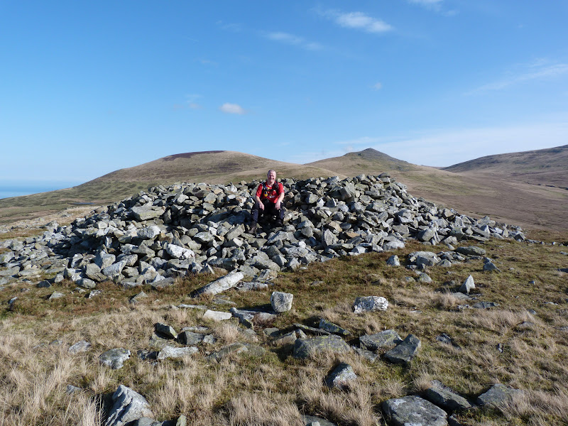
The summit of Moel Faban is soon reached and is littered with the remain's of an ancient settlement.There is a lot of little stone heap's and the remain's of 3 large Bronze Age Cairn's which have been adapted as shelter's.

Warm enough to walk in shirt sleeves we dropped down to Bwlch-ym-Mwhll-le which use to carry water to the Bangor Royal Slate Quarry.

Steeply up to the next top,Lefn,a wlde grassy top with good view's all round.Below is Moel Wnion,left and the rocky top of Gyrn,right.

Looking back in the direction of the Glyderau there was some lovely cloud's above.

We now headed for our third top,Gyrn.The walking in this area is very gentle and the view's amazing but they were about to get better as we gained height on Gyrn as this opened up the view toward's Aber Fall's and Llwytmor.Before we reached the summit i took a photo of a pony crossing in front of us,seen below.

Howie who was a little way back shouted to me to put my hand out,he tried to take a photo of the pony as if it was sitting on my hand,the boy done good.

Just below Gyrn's summit we found this little shelter.

Below the summit of Gyrn and the view toward's,left to right,Llwytmor Bach,Llwytmor,Bera Mawr and Drosgl.

There were quite a few people out walking today taking advantage of the great weather and after having a break at Gyrn's summit we pressed on to Moel Wnion but first we had a mooch around the impressive sheep pen's below Gyrn's summit on it's north side.


A gentle half mile stroll and we reach the summit of Moel Wnion which is marked by a broken trig point in a stone cairn.

Looking across to Llwytmor,Foel Fras and the Bera's.

If there any geo-caches on route i normally go to find them and i knew there was one less than a half mile away in the disused Pantydarren Slate Quarry so i said i would go and grab it.Little did i know it involved dropping down 800 feet to it.I was losing height quickly but the cache wasn't getting any nearer on my GPS so i just kept going because i didn't fancy climbing back up the steep slope.Eventually i reached the cache at the entrance to the disused quarry.


Looking back up to the cave entrance and spoil heap.

The downside of visiting this quarry was the height loss and the long walk back but the upside was the solitude and the brilliant view across to Aber Fall's and Llwytmor.


Locating a path high above the Afon Gam i headed in the direction of Cras and the North Wales LDFP.

I had to walk 2.5 mile with a 700 feet ascent before i reached the boy's who were waiting patiently for me taking in the view across the Menai Strait.I won't be making that mistake again and will only find caches that are on the route.Still the view to Aber Fall's and across to Anglesey was amazing on my return.Below a close up of Castell Beaumaris.

Skirting below Moel Wnion we headed toward's Bryn Hall and it's impressive gateway.

We then took a detour into the Bangor Royal Slate Quarry which used to be called Bryn Hafod-y-Wern to have a look at the launder pillar's.These pillar's supported the water pipe that was brought here from it's source,Cwm Caseg 7 kilometres away !

Returning to the road we passed the quarries flooded pit.Apparently it is 50 metres deep and contain's dumped WW11 unexploded bomb's and barbed wire.Unfortunately a diver died here in the 1970's and his body has not been found.

A gentle stroll across field's lead's into Llanllechid,passing St. Llechid Church.

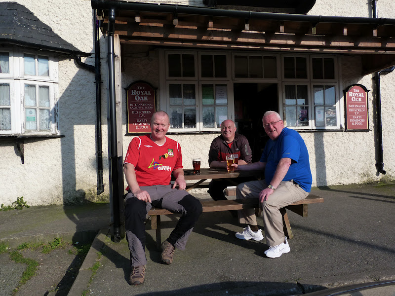
The sun still being very warm we sat outside the Royal Oak in Rachub to digest today's great walk
With my detour i walked a distance of 8.5 miles with 2,300 feet of ascent.
MILEAGE 105.5
ASCENT 26,200
TOPS 33.
No comments:
Post a Comment